Last weekend was a long one, owing to Dasara and Gandhi Jayanti. So decided to take off to my native place to attend some pujas and generally meet relatives. Since we heard that the normal Bangalore-Mangalore route was a bone-jarring one, we decided to take the alternate route through Mysore and Madikeri. And what a beautiful decision it was. We got to drive on the smooth flat Bangalore-Mysore highway, the enchanting Madikeri section and the neat Kerala roads. The weather was just perfect for the long drive - neither too hot not too cold and spells of rain in between giving a magical touch to the hilly countryside.
And stay there was perfect. Our house is nestled way up in the hills right under the shade of the highest peak
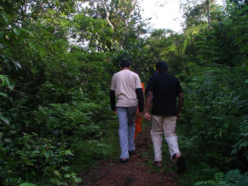
(Posadi Gumpe) in Kasargod district. All round, one can see the Western Ghats looming high in the sky. Now I understand why I dont get as excited as the other city-bred friends when we come across an impressive hill terrain during our treks. Guess I have been so used to such sights from my childhood days :-) I used the opportunity to get some good trekking and photography done. The monsoons which had just completed had left a lush green tinge on everything available.
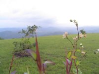 | 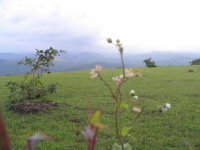 |
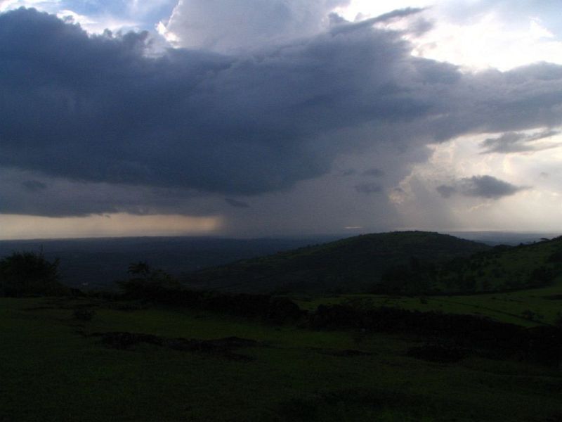
Standing on top at the peak, one can get a clear view of the Arabian Sea far on the horizon. Though, this time, the view was blocked by huge rain clouds. On a clear day, you can also see the Kudremukh peak far up north from Gumpe. Another feature of this peak is the 5 deep, yawning holes situated just near the peak. According to my uncle, legend has it that the Pandavas used these to hide during their vanavaas. One can drop a stone in one hole and hear a clunk deep down through the other hole which means that all of them are interconnected somewhere deep down.
Here are two panaroma shots I took of the view from Gumpe - one a 360 degree view from the peak and another of the hills merging into the Arabian Sea.
Well, the blogger pics aren't large enough to make out the details. You can find bigger, clearer shots
here and
here(I uploaded them on Webshots).
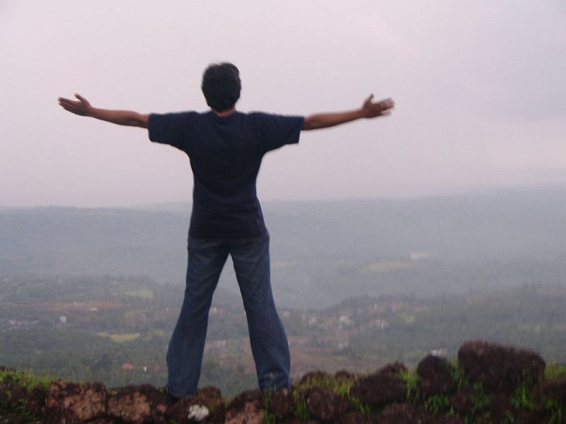
One can see the Arabian sea waters shining under the sunlight escaping from the clouds bang in the center of the below pic on the left. Another one of me just waiting to take off into oblivion :-D
We climbed up the hill at around 5 in the evening. Could see huge rain clouds pouring their fury on some hapless town far away. Enjoyed being on top for about 2 hours and then descended down. About halfway down the hill, we visited the house of one of our relatives who lives up there. By them time we started down again, it had started raining and the rocks became slippery. But the experienced cousin of ours directed us in the dark and we safely reached our destination.
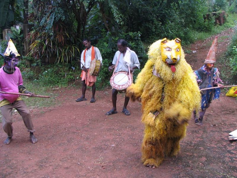
Another fun thing was the Hulivesha - which is an integral part of South Kanara and Kasargod during the Dasara festival. Troupes of people (as part of a religious vow) dressed up as tigers/lions/cheetahs, hunters, jokers go house to house and dance for each household in return for some money. The music is really foot-tapping and its pretty interesting to watch the dance. We had one troupe visiting our house which I have captured on camera.
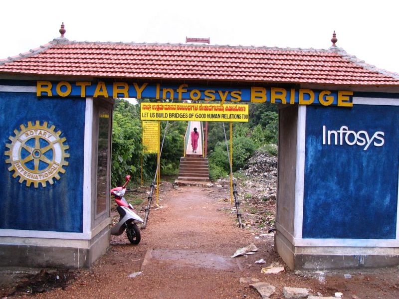
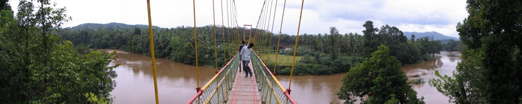
On our way back to Bangalore, near Sullia, we saw a hanging bridge built by Infosys and the Rotary Club of Sullia. It was a really cool experience walking on that bridge. Pretty surprised to see the Infosys name in Sullia. Never knew that bridge existed until now. Walked on it and clicked some pics around.
The roads in Kerala are just too good. Even the roads connecting the remote villages and towns like our village have smooth tarred roads. The best example was while returning, near Sullia, they have a huge board saying "Welcome to Karnataka" and just beyond one could see gaping potholes welcoming us with open arms, feet, everything! Was too overwhelmed at that time to remember to click it on the camera, though.
While the same road until then in Kerala state was a featherbed. Same was the case when moving from Londa to Ponda on the way to Goa. Guess its just one of the pitfalls of being a larger state with larger area to be administered. But still, something to learn from the neighbouring states.
Stopped at an uncle's place at Virajpet near Madikeri on the way back. That is a beautiful town in itself. There is a clock tower at the town center which was built to commemorate King George's coronation in 1911!! Also, got a view of the Western Ghats rising above the forests far in the background.
On the whole, a pretty interesting and satisfying trip. It helped that I wasn't driving this time as my brother took complete control. Just chilled around in the backseat humming (or is it nose-ing??) away to Himesh's tunes :-D
Directions to Gumpe:
From Mangalore - Take a left at Pumpwell towards Kasargod. Travel about 35km to Uppala. There is a left turn here which leads you to Bayaru village past Paivalike. Take the right turn at Bayaru and proceed on the winding road among the hills towards Gumpe. The Kerala Government has put up tourist signboards at various places for assistance. Or any local can easily guide you to Gumpe.
From Kasargod - Travel about 20km and take the right turn at Bandiyodu. Travel on the Dharmatadka road for about 20km and follow the road directions to Gumpe.
You will get buses that go till the foothills of Gumpe. From here, its short 20minute walk uphill to the peak. There are no eating/resting places at Gumpe itself. Nearest hotel is at Bayaru while the nearest town is Uppala.